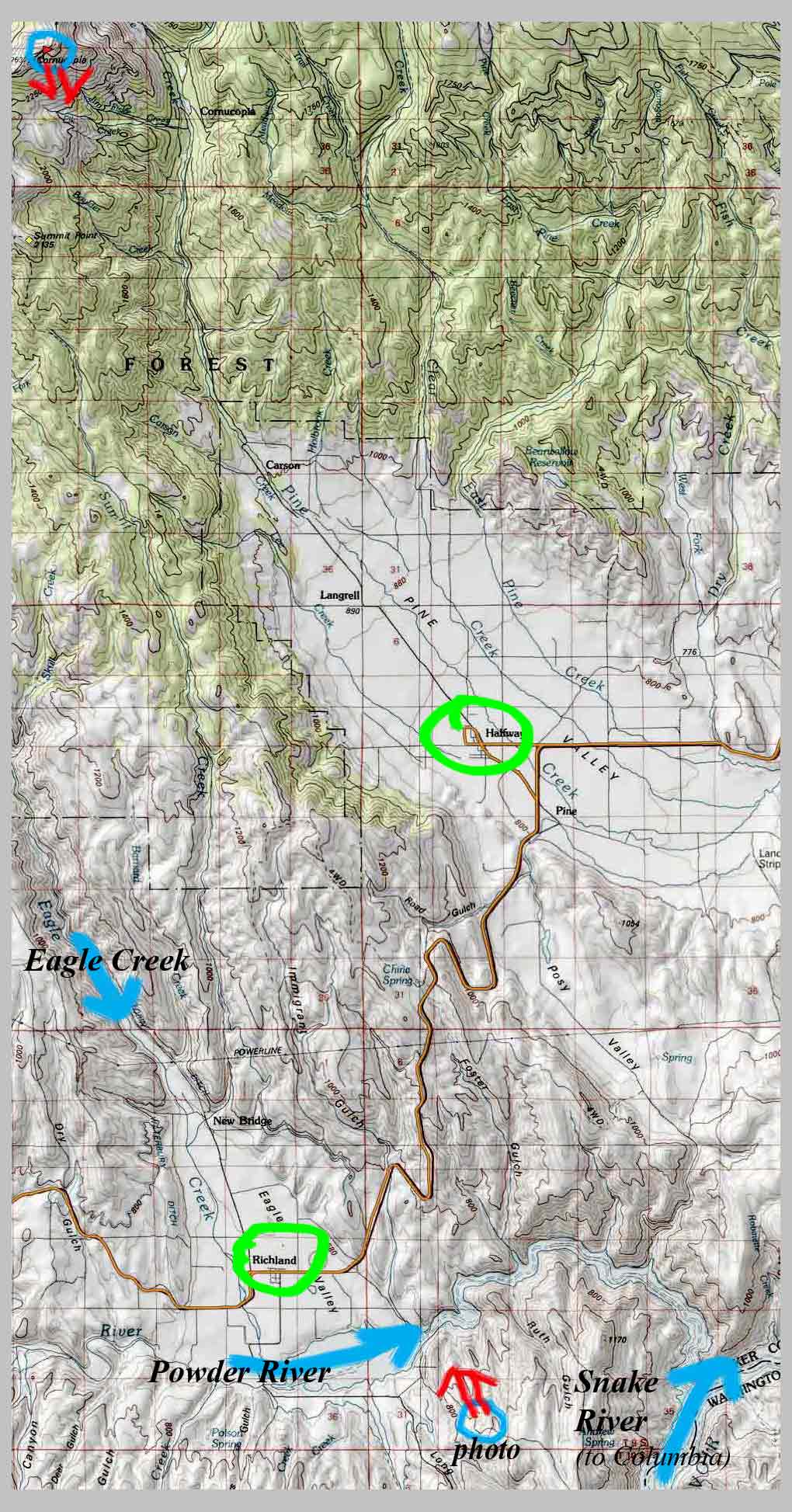
Topo Map, from rim Snake River Gorge (± lower blue circle) to
Cornucopia Peak (upper blue circle), with small, sister,
flatland ranching communities of Richland (little snow)
& Halfway (lots of snow) circled in green, South Wallowas . . .
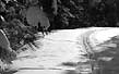
Photo was made from lower right of map and show a diagonal
cut to Cornucopia Peak.
| click here or on map for larger view |
On the road in the Northwest of America.
NEW:
To view / purchase
different sized prints of this image at the
PhotoWeek Store click here.
view as SLIDESHOW
|
[http://www.shutterfly.com/pro/cliffcards/photoweek]
| back to Picture/Poems:
Central
Display |
go to P/P Photoweek: Archive
|| or go to last week's PhotoWeek pages |
|
Map
|
TOC:
I-IV |
TOC:
V-VIII |
Image
Index
|
Index
| Text
Only
| Download
Page |
Newsletter
|
About
P/P |
About
Cliff
Crego |
Photograph by Cliff Crego © 2008 picture-poems.com
(created: II.3.2008)